

DALLAS – A severe thunderstorm warning and flash flood warnings are currently in effect.
Several tornado-warned storms moved through North Texas earlier in the night, but all tornado warnings have expired at this time.
In addition to the tornado threat, people are seeing hail and heavy rains.
Severe Thunderstorm Warning
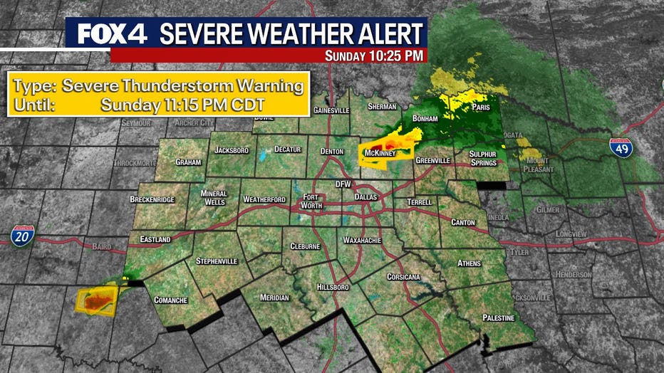
Severe Thunderstorm Warnings are in effect in Collin County until 11:15 p.m.
Flash Flood Warning
A Flash Flood Warning was issued for Denton County until 12:30 a.m.
Tornado Watch
A Tornado Watch is in effect for Denton County and Collin County until 11:00pm.
Live North Texas Radar

North Texas Storms
FOX 4 viewers have sent in photos of storms as they move into the area.
Seth Jackson sent photos from Ranger, about 80 miles west of Fort Worth.
Viewers sent several videos and photos from Santo, about 50 miles west of Fort Worth.
Baseball-sized hail was spotted in some areas.
Viewer Keshia Carlton shared video of two funnel clouds in the Santo area.
Monday Forecast
There is a potential for a morning complex of storms on Monday, which could affect the chances for afternoon storm development.
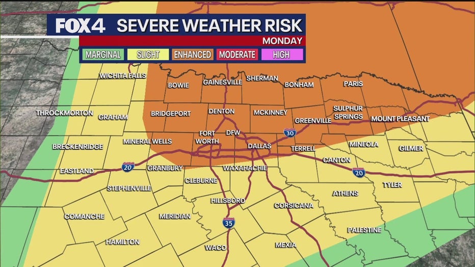
Regardless, all modes of severe weather are considered possible on Monday, with a slightly higher severe weather risk anticipated compared to Sunday and Saturday. These storms will develop later in the day and rapidly move to the north and east.
Residents are urged to “stay weather-aware” for the next two days, particularly late Sunday night and throughout Monday, and to ensure they have a way to receive weather warnings.
A cold front is expected to arrive on Monday night into Tuesday, ushering in drier air for the middle of the week.
7-Day Forecast

The Source: Information in this article comes from the FOX 4 weather team.

